Aerodrome Safeguarding
& Inspection Tool
Instant, affordable ICAO-compliant aeronautical obstacle assessment. Annex 14, PANS-OPS and full PBN procedure evaluations in seconds — no installation, no login required.
Instant, affordable ICAO-compliant aeronautical obstacle assessment. Annex 14, PANS-OPS and full PBN procedure evaluations in seconds — no installation, no login required.
Altitude Nexus ASIT is web-based 3D obstacle assessment software for ICAO-compliant safeguarding. Built for Civil Aviation Authorities, airports, wind farm operators and applicants, it automates ICAO Annex 14, PANS-OPS, BRA, custom surfaces and full PBN flight-procedure protection areas. It provides free multiple-point checks, world 3D terrain/building context and clear compliance results instantly without software installation, making aerodrome safeguarding accessible to aviation and non-aeronautical users.
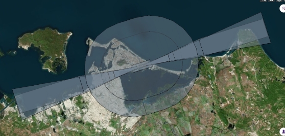
All Annex 14 OLS surfaces. Automatic infringement detection.
View module →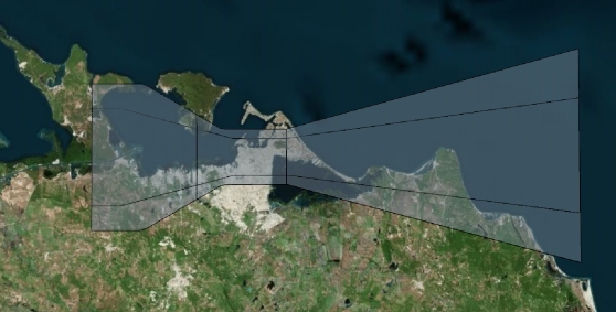
Non-precision RNP APCH obstacle clearance surfaces.
View module →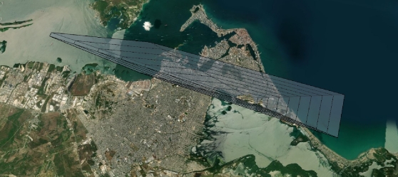
ILS CAT I/II/III & APV-Baro obstacle assessment surfaces.
View module →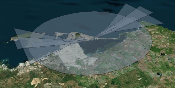
New ICAO OLS framework — mandatory by 2030.
View module →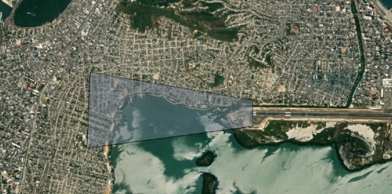
Visual Segment & Obstacle Clearance surfaces.
View module →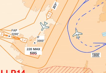
Full ICAO‑compliant PBN procedures: holdings, racetrack, base‑turn, 45/180 turns, SIDs, en‑route, STARs, approach and missed approach.
View module →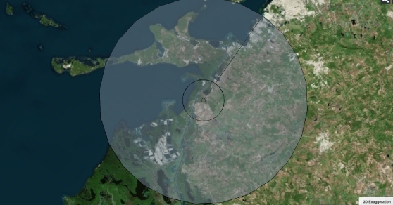
Navaid Building Restrictive Areas per ICAO Euro Doc 015.
View module →Upload and evaluate any custom-defined protection surface.
View module →From setting up your first aerodrome to running a complete ICAO Annex 14 OLS analysis and downloading an official PDF report — this walkthrough covers the entire workflow.